
Dutch River
A night walk from Kirk Sandall to Goole

An overnight walk from Kirk Sandall to Goole, via the River Don Navigation, the New Junction Canal, the Aire and Calder Navigation and the Dutch River. 6.30pm Friday 25 July to 5.30am Saturday 26 July.
6.31pm. I step onto the concourse at Kirk Sandall railway station and I try to remember when I was last here, alone, the summer of 2015, perhaps, and I haven’t rewalked this route since. A ramp to the road bridge. A left from the station exit, this is instinctive, I don’t examine it too closely.
I turn left and keep walking, here is an industrial park, and here is another, and I try to fill in the rest from memory. Faint and haphazard impressions. I consider taking out the OS map, and think no, it isn’t time, I take photographs instead, the containers, the lorries, the loading bays.
Already, this walk feels like an anomaly, or an afterthought, a round trip that doesn’t add up. An improvised escape route. Time out from the city. A haulier steps out of his cab and examines his tyres. I turn right, then turn back, Pilkington Road, the name is familiar, I don’t know why.
I recall the route but I don’t recall the landscape. Pipe House, a corrugated steel shed, Kayser Building Supplies to my left, a nondescript new estate to my right. I remember blackberries, the abundant wayside blackberries, they’re still here, unlooked for and ripe in the brambles and thickets.
I also recall a little church, and here it is, at the end of the road, hemmed in by uninspired housing but still a church, St Oswald's, closed for decades now, its headstones screened by trees, and then the embankment, the opening out, the path to the river is still the path to the river.
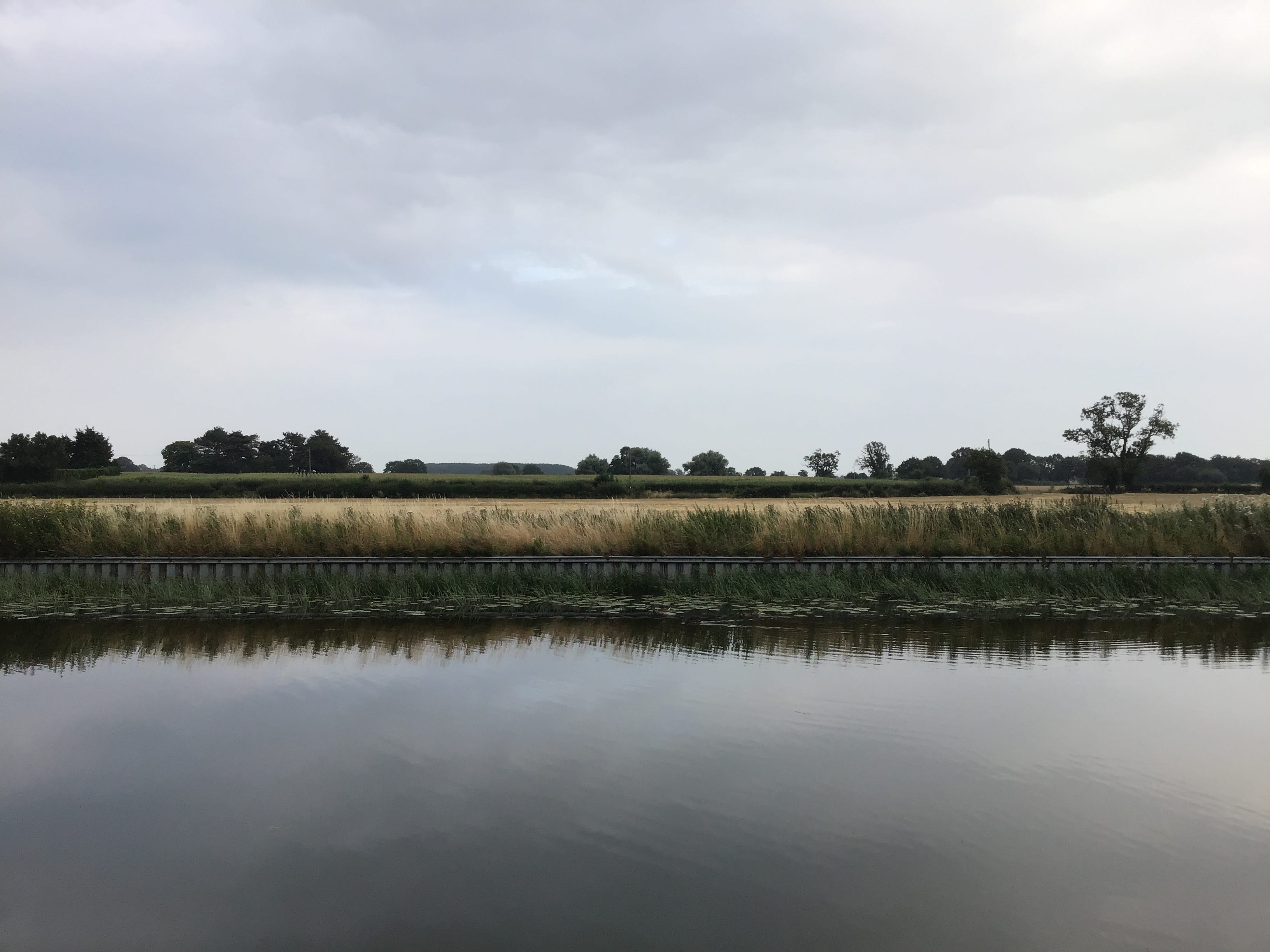
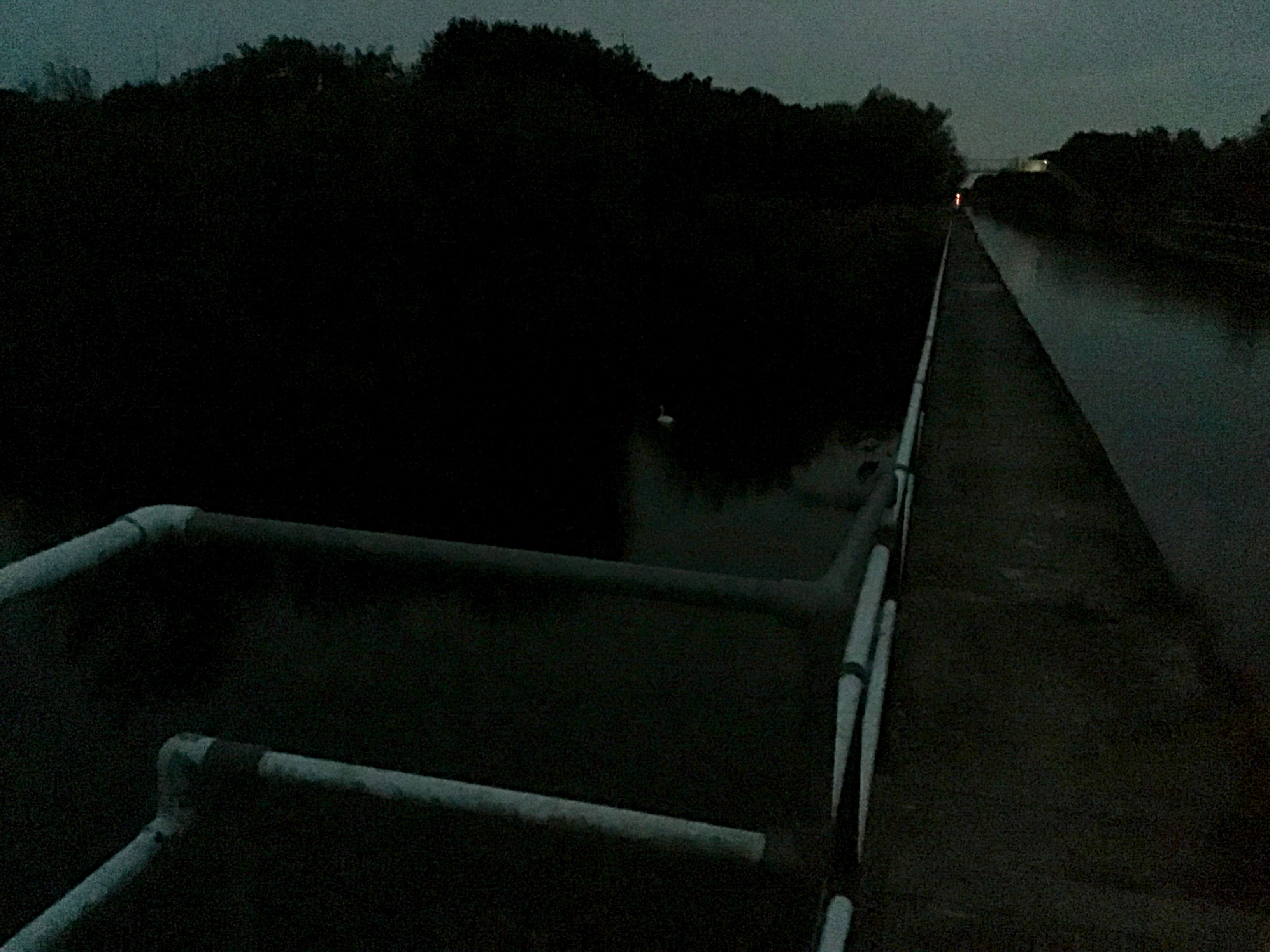
This is not the path to the river. This is not the River Don, but the River Don (or Dun) Navigation, the two courses almost parallel, here, according to the map, then twisting away, one north, one northeast. Evening on the towpath. Dogs are walked. Swallows flicker and flit. Water is unmoved.
And no movement anywhere, this side of the navigation, as if all is gauze, sterile scrim, then I remember myself, the boots on gravel, and sweat breaking the skin, and see my own shadow pass through the shadows of overhead wires. A veined white butterfly, and another, the movement is all of them.
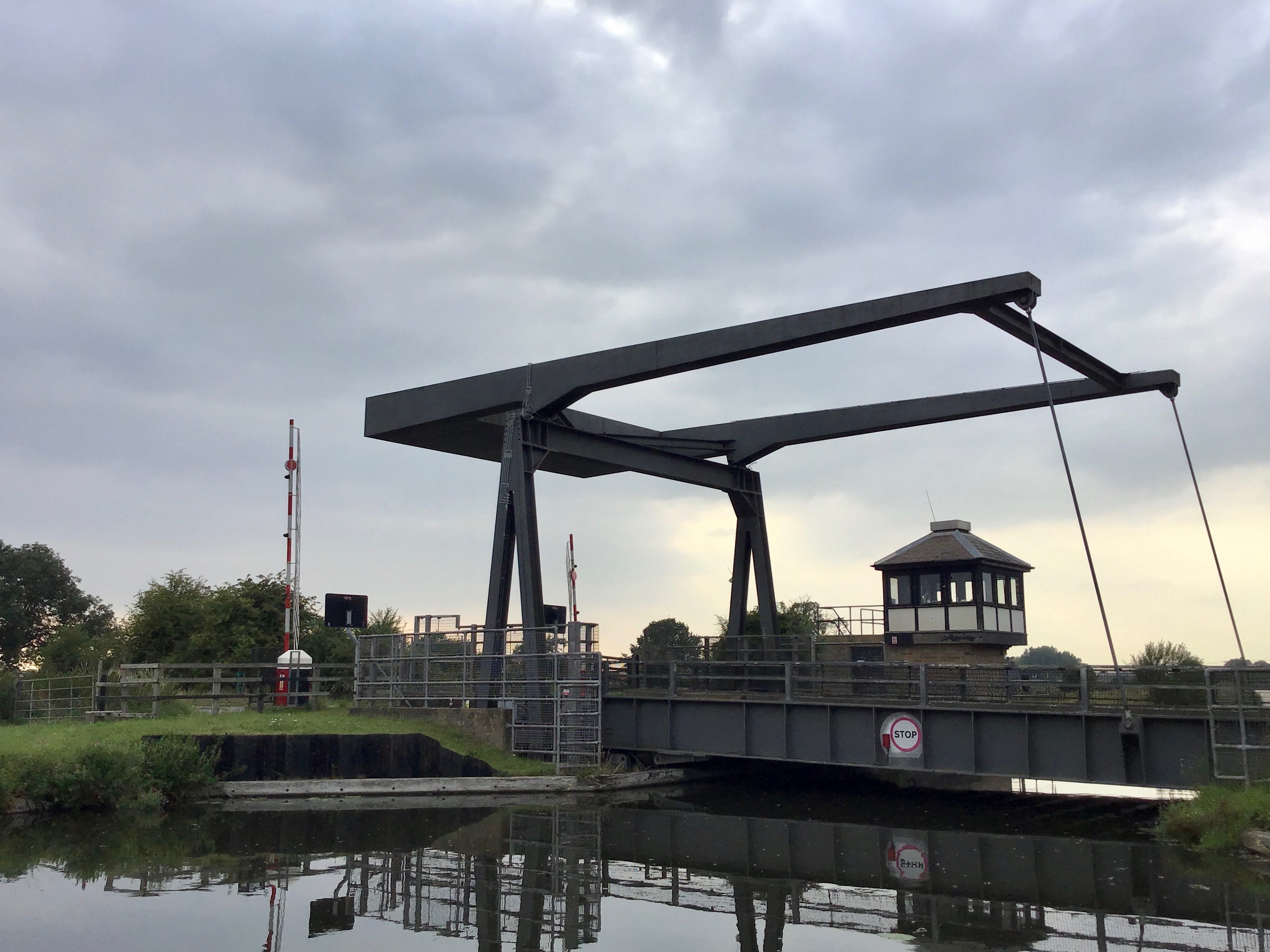
6.55pm. The towpath widens to a tarmac car park then narrows to a grass path, running alongside three brick terraces set behind the embankment. Barnby Dun. Three narrowboats at the moorings, a dozen people in folding chairs, a lone fisherman at the end. The level crossing and the lift bridge.
7.05pm. This is a small journey, and the rucksack is stuffed, the water is half the weight. The maps and the camera take up space, along with a discounted carrot cake I bought in haste in Sainsbury's and now have no appetite for. Satsumas, paracetamol, black bin liner.
7.09pm. I pass under the railway bridge and stop and stare into the south-west and make a dozen copies of the near distance while thinking of the far distance. Ten years ago I stood here and tried to line it up in the viewfinder. I didn't know what I was looking at then. Thorpe Marsh substation.
To set out at evening, a sight to behold, with nothing to show for the day's efforts, other than the show of effort. To start at the end and with no end in sight. To stall at the outset, two hours before sunset. To set one's sights on nothing. To show oneself at evening.
7.34pm. Something enters the canal, or leaves the canal, all I hear is the echo, all I see are the ripples. Then stillness or the appearance of stillness. I spend several minutes studying the water but nothing breaks the surface. The towpath curves east and the navigation splits in two.
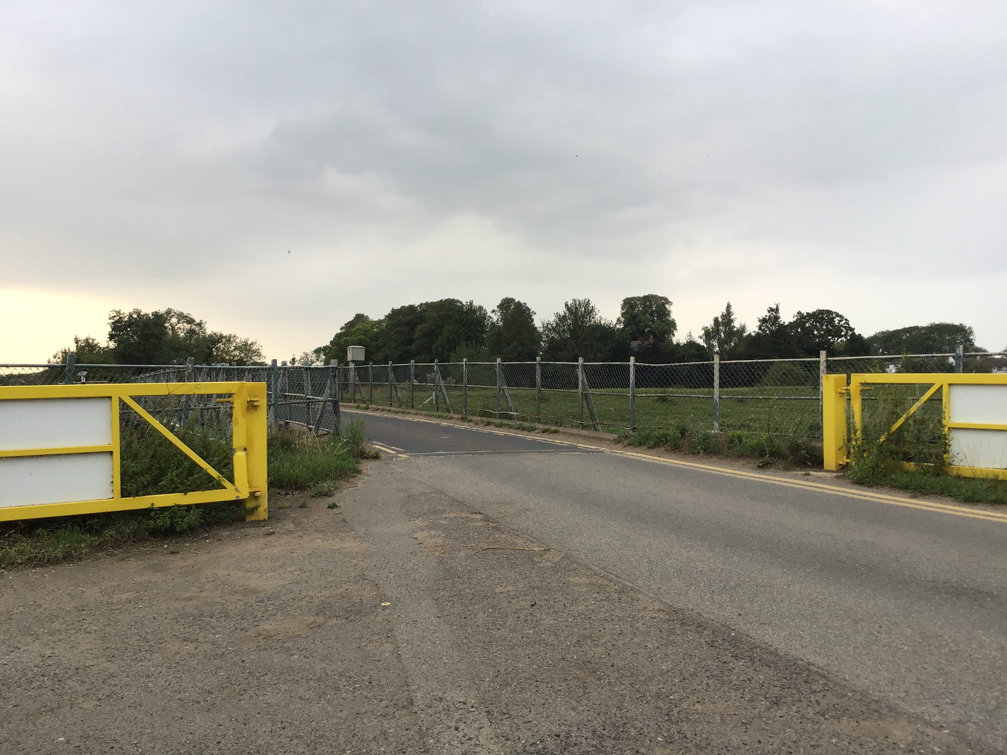
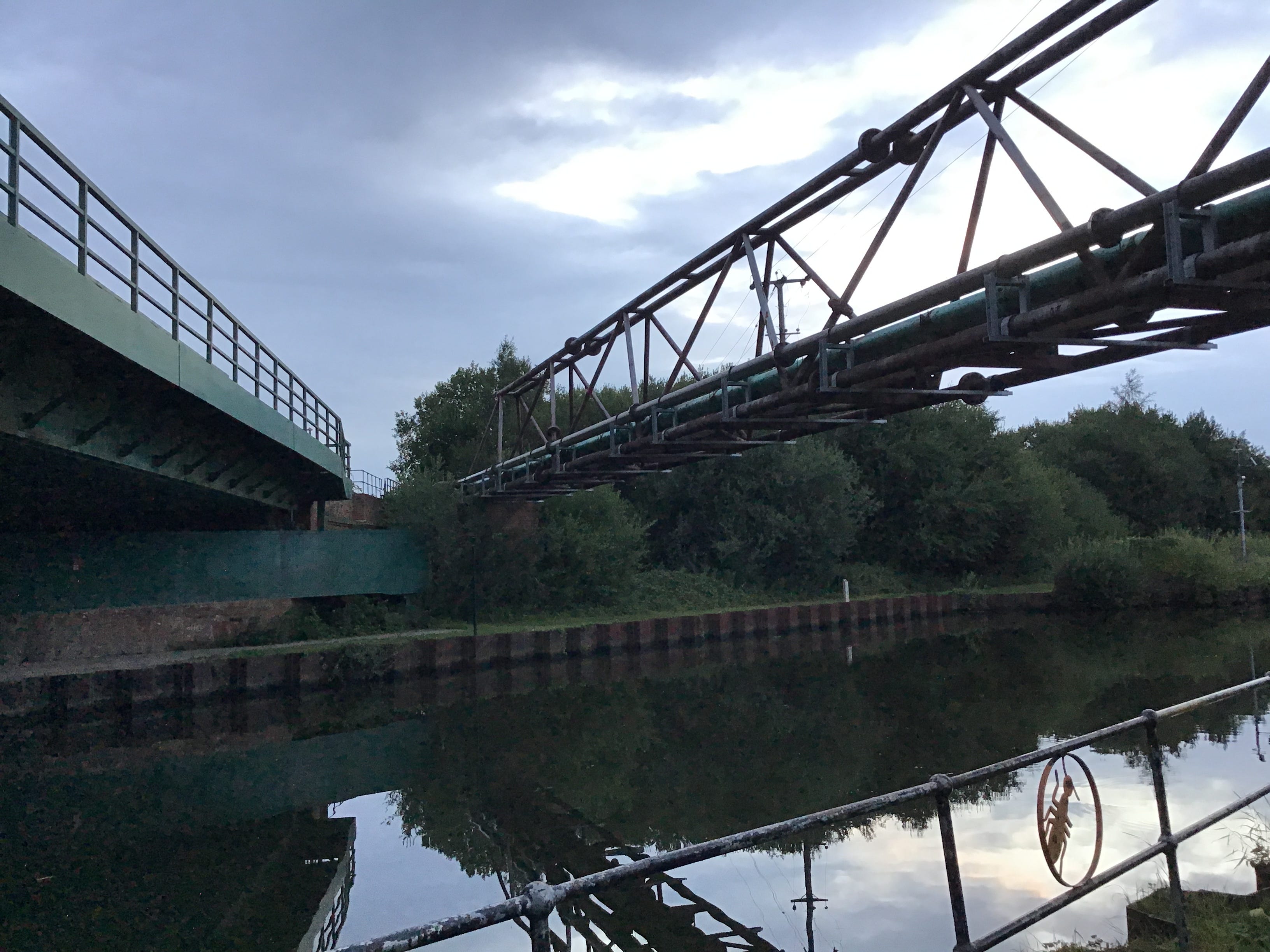
Low Lane. One road, two bridges. A swing bridge spans the navigation, while a fixed bridge crosses the Don, the waterways divided by an embankment, and both visible from a central vantage. Road traffic is managed via a system of level crossings and folding gates. I cross one Don, then the other.
7.44pm. The Norman church at Kirk Bramwith. The gates are closed. I step towards them, then step back, no, not at this hour. I remake it in the moment, the butterflies on the headstones, the lines on the memorial bench.
St Mary's, Bramwith.
The berries cupped in one hand,
staining the palm red.
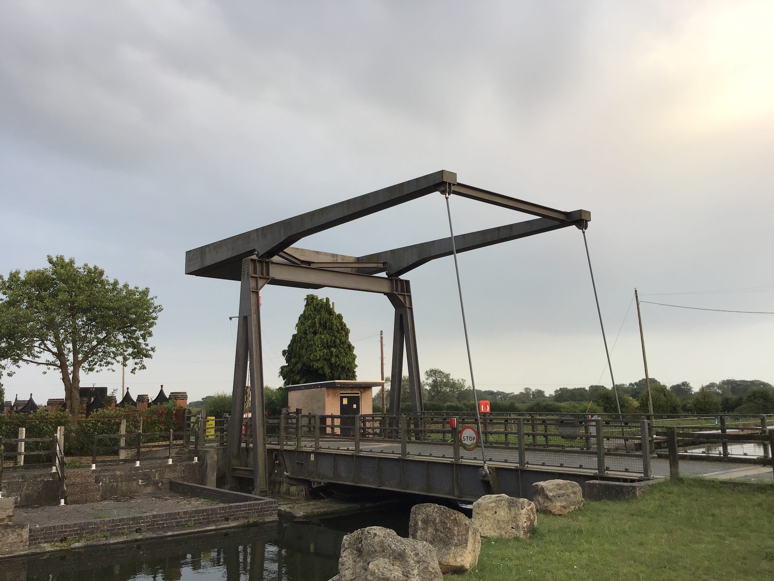
Opposite the church is a green and on the green is a seat. I spend twenty minutes on the wrought iron bench, in the shade of an old oak, and drink water, message Emma, unfold and refold the map. I walk out of the one-street village, flat fields to the east, and cross the lift bridge at Top Lane.
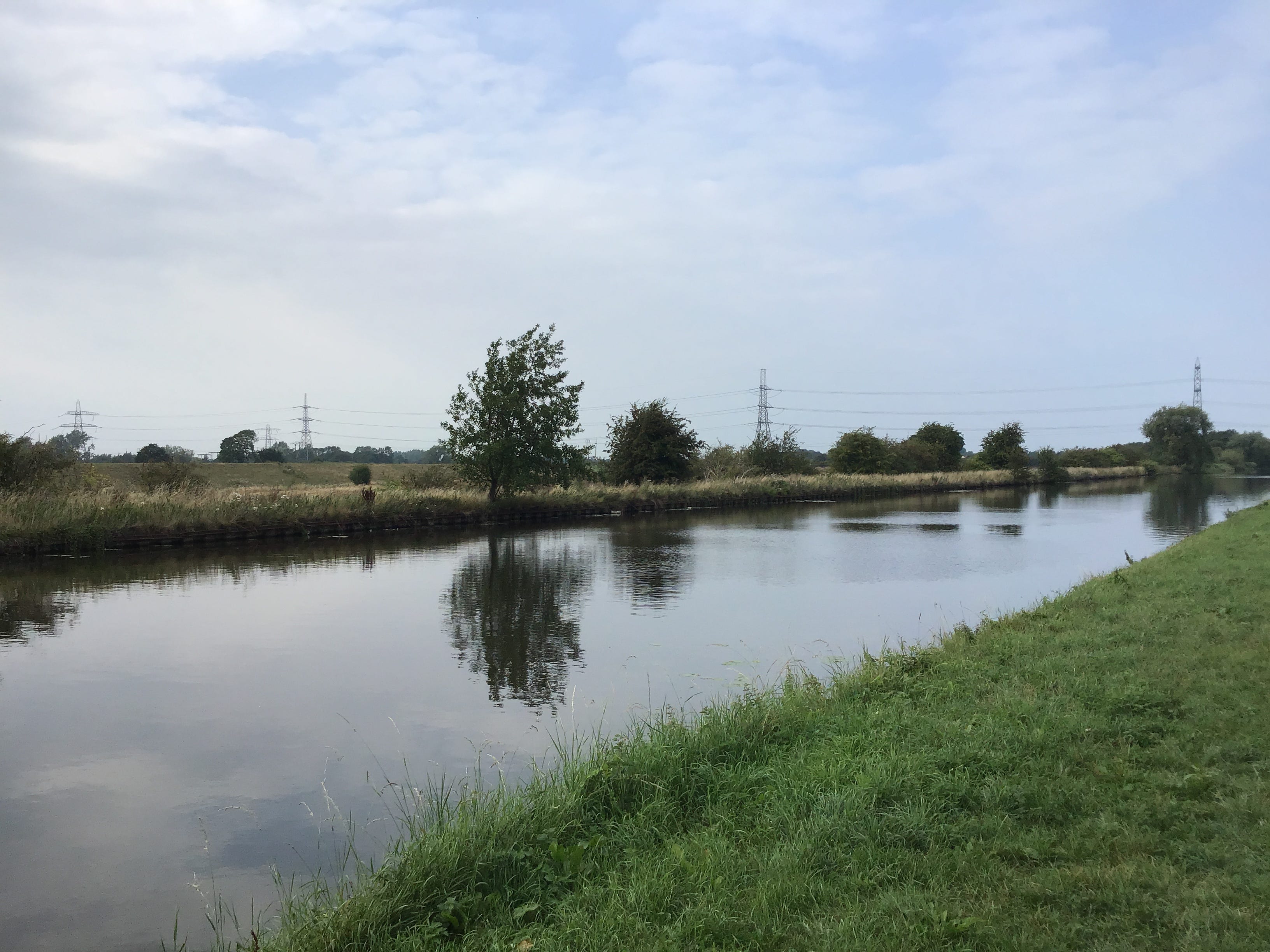
The New Junction Canal is arrow-straight for its five-and-a-half miles, a clean blue cut, north-north-east from the Don aqueduct to the southwestern edge of East Yorkshire. I weave through the A-Frame barrier and start up the towpath. All the wide water to my right. This makes me uneasy.
To see myself on the wrong side of the channel. As though I have been cut off from something, something in the east, or something in myself, with no reconciliation. No right turns. I know this route, I have done the mapwork, I push through the disconnection and set my shoulders to the path.
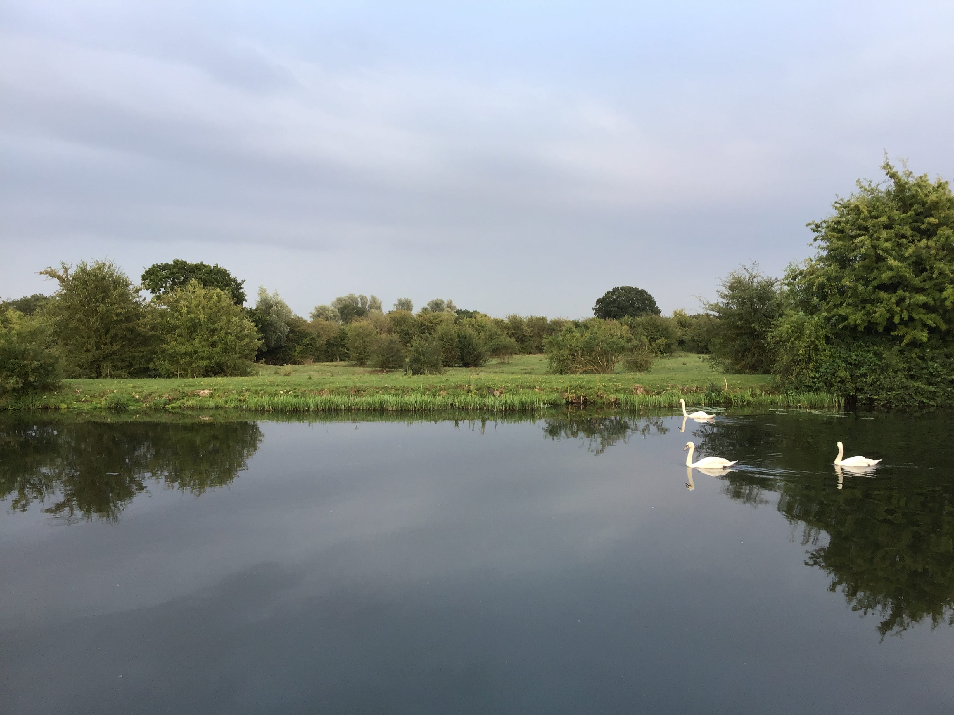
8.33pm. The canal seems to precipitate a condition of total suspension. The light doesn't change. The heat sticks fast. The outlook is undisturbed. This holds for ten minutes, perhaps more, perhaps less, and is slowly broken down by one, two, three swans, skimming the edge of my visual field.
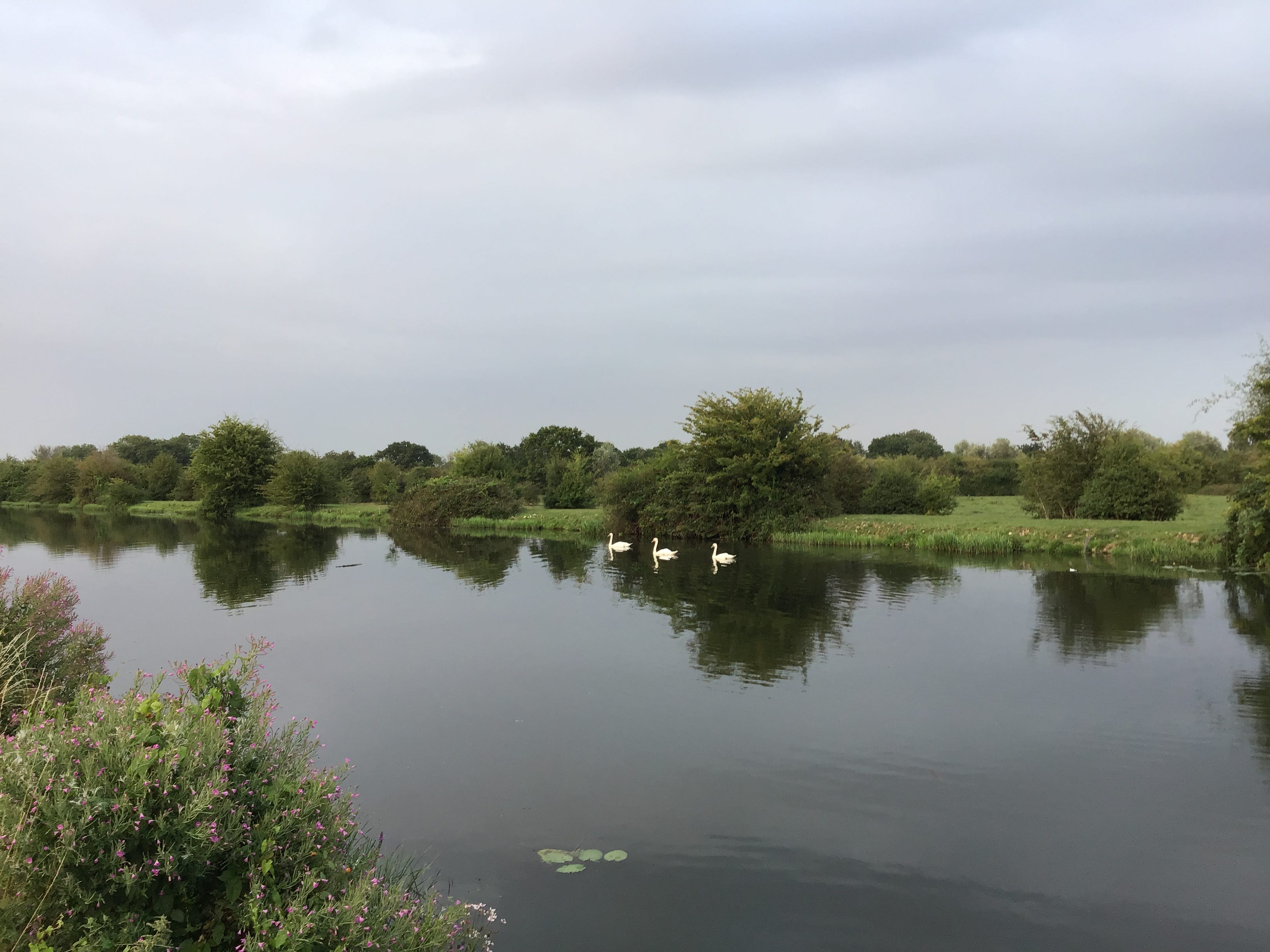
I stop to photograph the swans as they file north along the east bank, six or seven shots, the balance shifts, the composition falls apart. Distant white dots. I catch them up a few minutes later and stand still for the twenty or thirty seconds that it takes them to enter and exit the frame.
8.55pm. Kirkhouse Green. Ten years ago I passed through this landscape in a state of almost perfect unknowing. I made mistakes. I took notes. I shelved the experience at the back of my mind, like a pebble plucked from the shoreline, and its lustre wore off. Too late, now, to pick it up again.
A heron rises from the distant bank, a dark swell against the darkening water, blinking out of eyeshot. Somewhere a dog barks. I look up at the overhead lines, running west to east, then look down at the towpath, the numbered moorings, 384, 385, 386, and the lines and numbers add up to a grid.
9.22pm. Sykehouse Lock. I cross the swing bridge to the east bank and proceed along the towpath until I see a sign that advises me to turn back. I cross back to the west bank via the lock and find a gravel track that runs parallel to the moorings. Five minutes later I meet six feet of steel mesh.
The vehicle gates are locked. I try the side gate and, with some effort, manage to slide back the sprung latch and ease my way through. The signage on the other side informs me that this is a private road and a permissive path and that the gates are locked at dusk. It is dusk now, civil dusk.
At the end of the track I cross Kirk Lane swing bridge and pick up the towpath on the east bank. It's still warm, and there is almost no wind, but there's a change in the air. The first few lights in the distance. Two narrowboats at rest. Swans in ones and threes and fives but never in pairs.
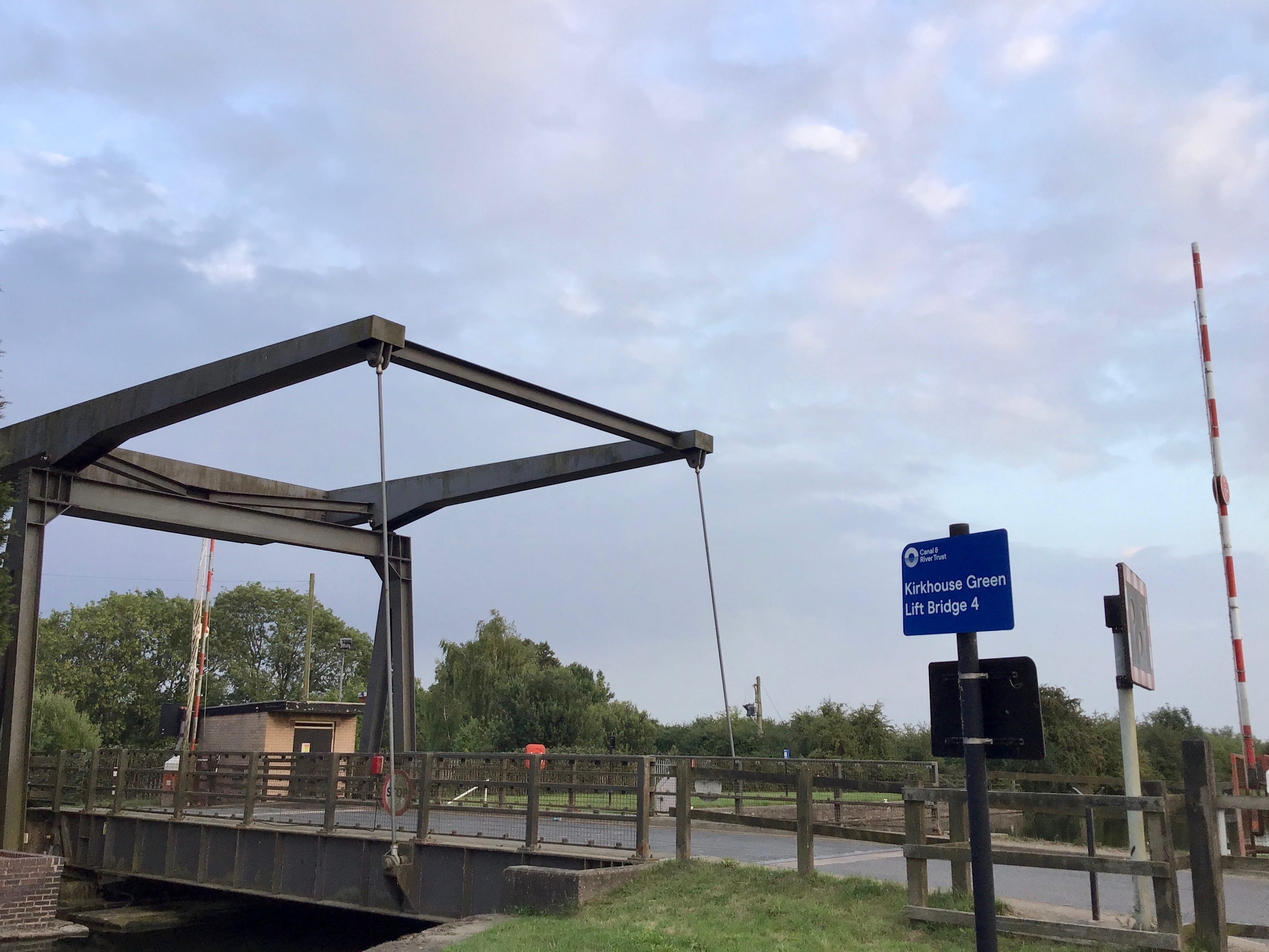
9.40pm. Sykehouse lift bridge. I'd intended to make the whole journey in darkness but it became necessary to reorder the day’s work and I set off five hours ahead of schedule. Is a night walk still a night walk when the light is low and never wholly absent. The notes are still legible, the images dim.

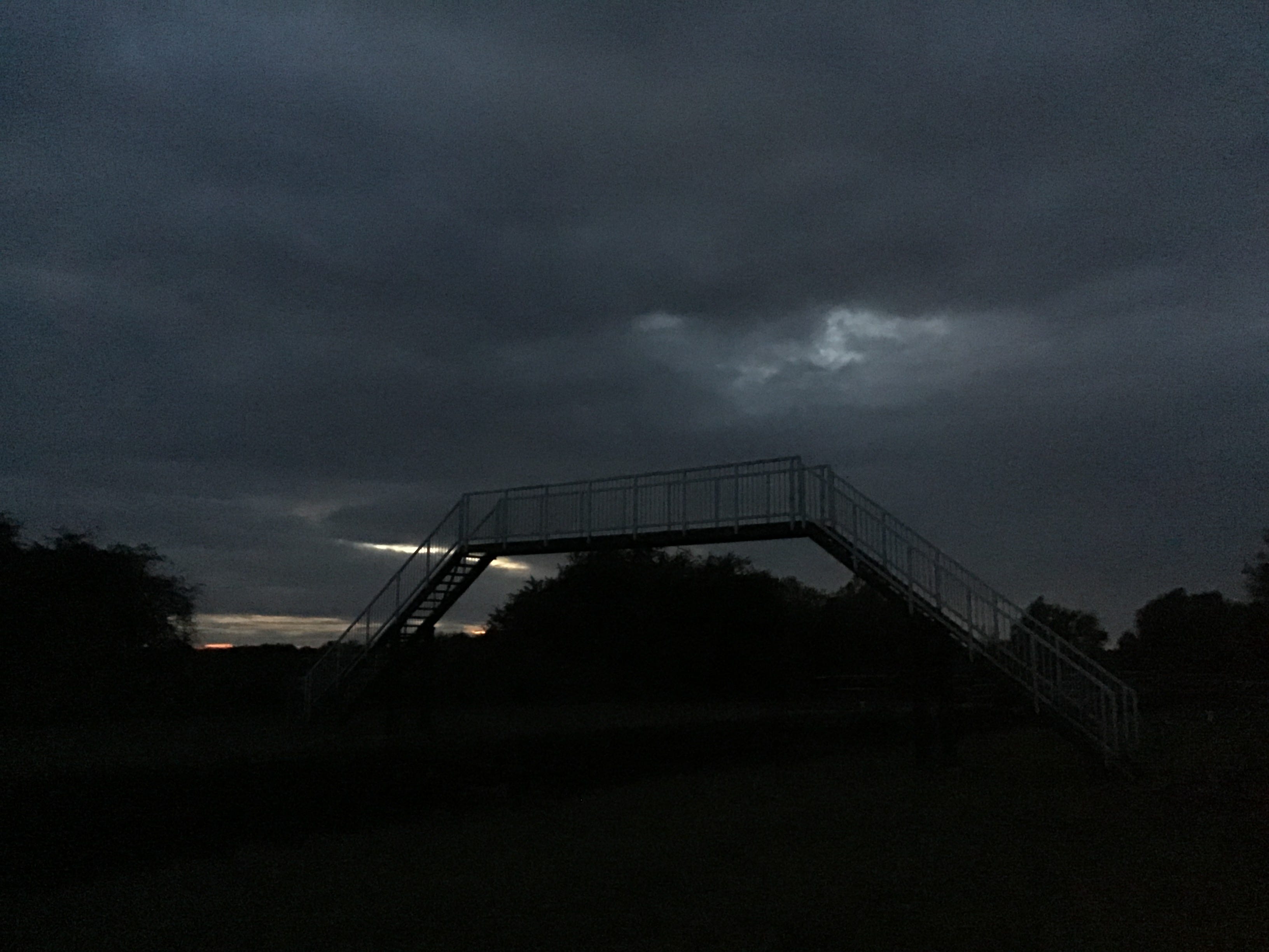
9.56pm. Noise and light from the west bank, on the move, north to south, two young men with flashlights. We draw level near the footbridge and one of them shines a torch across the water. I block the light with my hand. A shout of apology. At the foot of the bridge, rucksacks, bikes and rods.
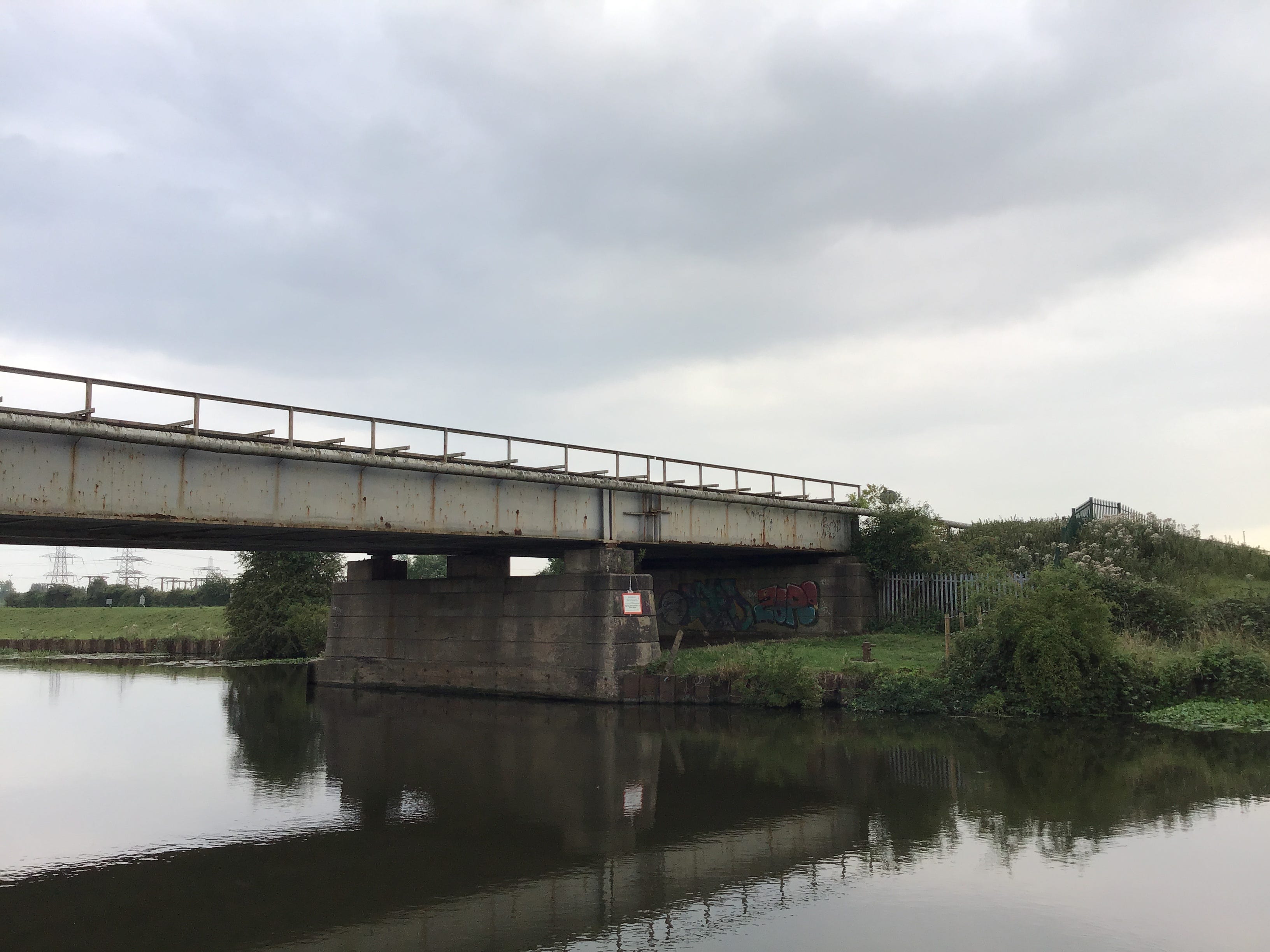
The canal narrows abruptly and the towpath yields to a concrete footway and an iron rail. The sudden elevation is an aqueduct, crossing the river Went, a mile west of its junction with the river Don. I stop, turn, and peer over the barrier, and count three swans on the wide dark water below.
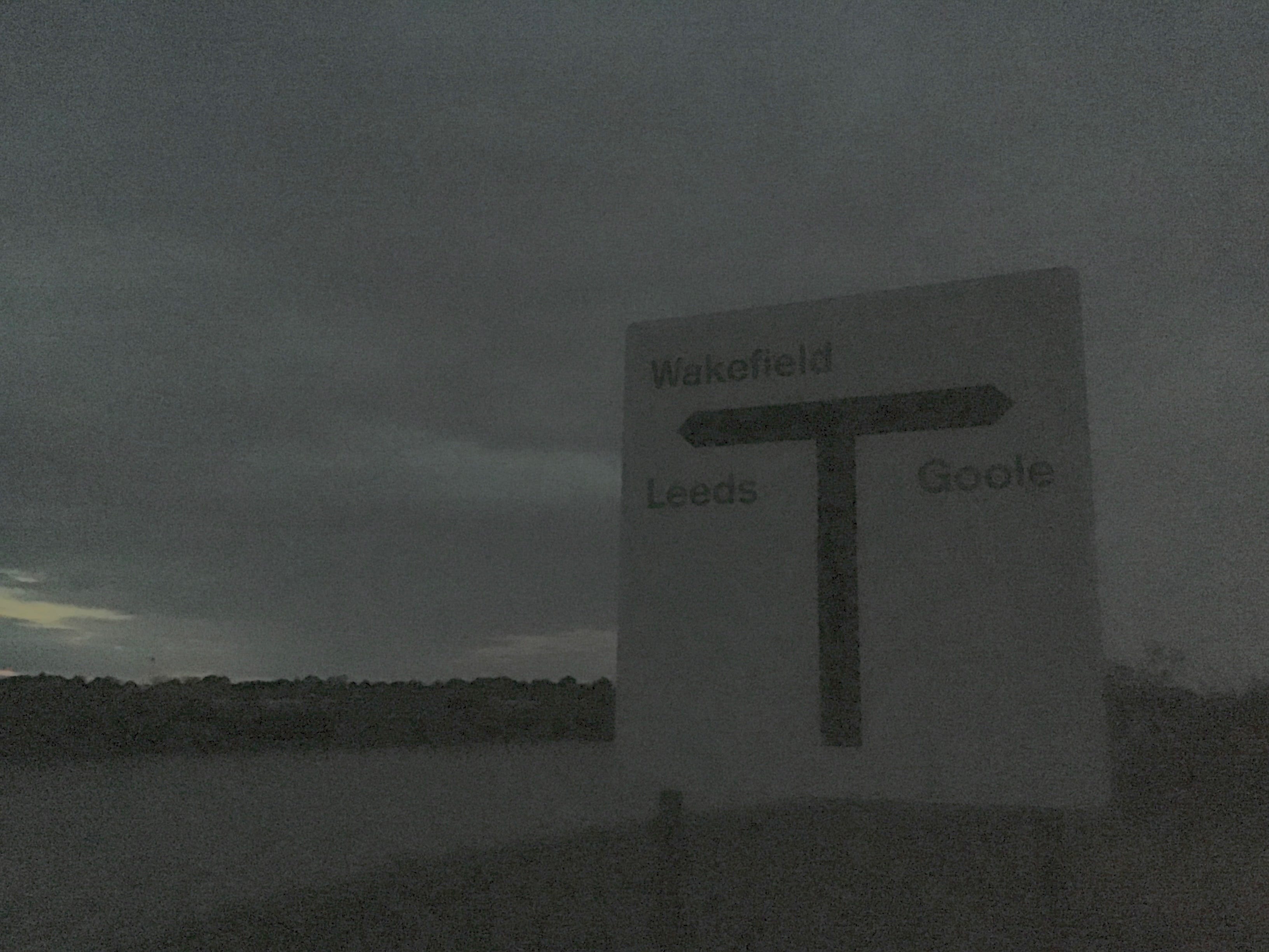
10.05pm. The Went marks the boundary of South Yorkshire and the East Riding. There's nothing on the towpath to announce this, but I pass one sign welcoming me to the Aire and Calder Navigation, and, two minutes later, another with directions to cities and towns to the west and east. Last light.
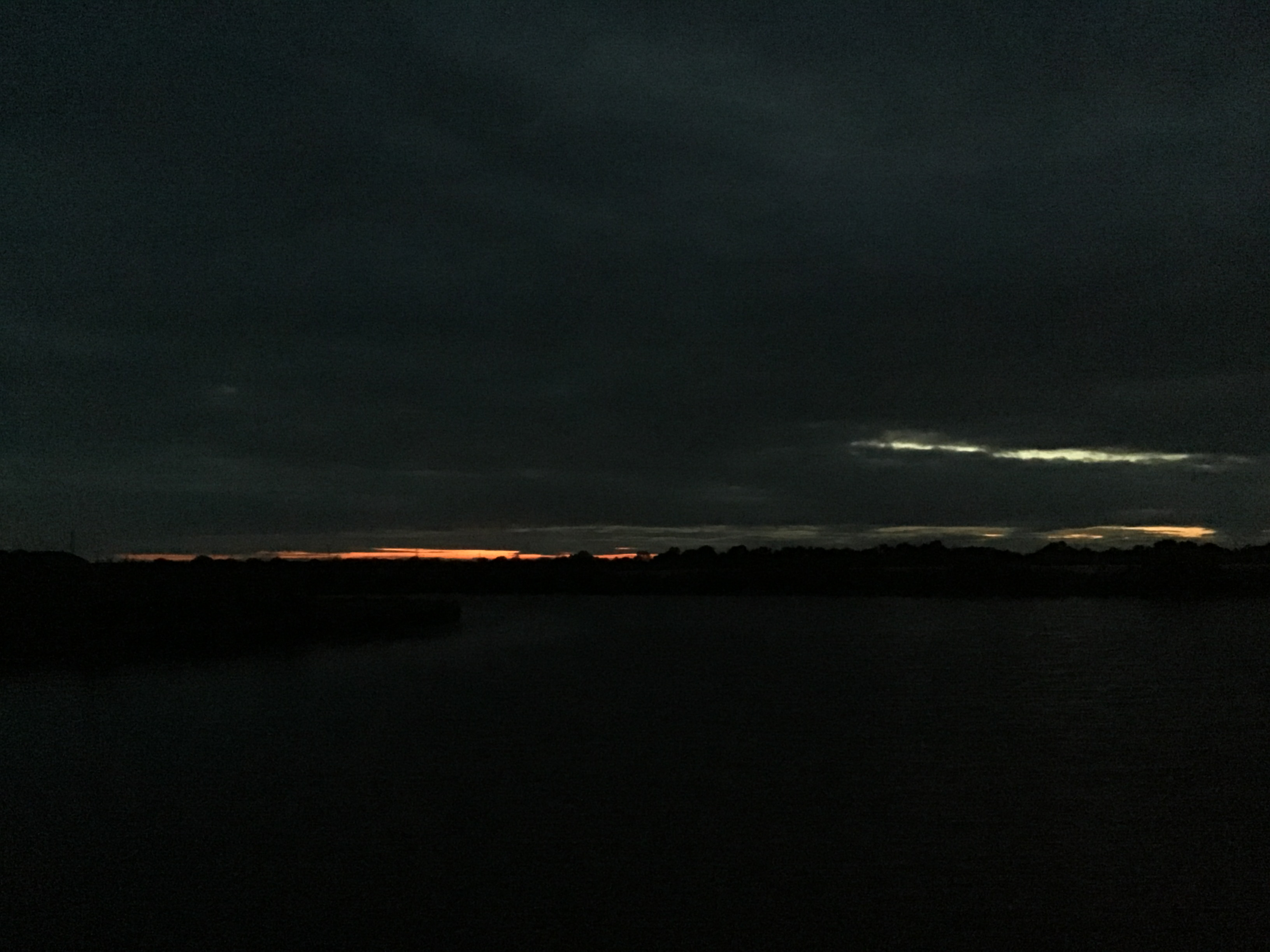
A safety boom, comprising a dozen buoys, divides the navigation from Southfield Reservoir. I hear voices from somewhere near the end of the thin tree-lined embankment on the other side. The scent of smoke, the makings of a fire. Then silence. A hole in the horizon drains the dregs of the sunset.
Noise and light on the path behind me, and it must be the young men from the footbridge, they are on their bikes and are shouting that they can't see. I step aside to let them pass. "Out on a long walk, are we", the first one remarks, it is not a question, they don't wait for an answer.
10.40pm. I stumble on an exit from the towpath, stepping down from the embankment to a copse, a drainage channel, a farmer's field. It is still warm. I take a worn fleece from my rucksack and a black bin liner. I lay the rucksack down at the field edge and spread the bin liner against the grass slope.
10.45pm. I lay my body on the liner and let my skull settle in a hollow of the rucksack. If this holds it should give me an hour's sleep. More or less. Gurgling of field drains. Mosquitos at the hands and face. Constellations brightening and softening. All the distances drawing close.
12.10am. Crumps for half an hour, somewhere to the south, muffled and arrhythmic. Otherwise quiet. No loss of heat. I stand up, pack the bin liner in the rucksack, and walk back to the towpath. Grainy cloud. Few stars visible. To the north, a nebula of light and vapour, low on the horizon. Drax.
12.30am. A Nissen hut, a low bridge, two houses on the other side, sensors flooding the towpath with LED glare. I stand at the edge of the overspill and scribble notes for half a minute, then hurry on. Two red lights in the distance, reflected on the water. The navigation curves north.
1am. A well-lit facility, perhaps a depot, somewhere to my right, and the motorway in and out of earshot. A sharp turn east. The red lights are somewhere else entirely. A bridge with several height restriction barriers, evenly spaced, silhouetted overhead. Some infrastructure that I can't place.
1.25am. The only constants are the uneven grass path and a strange reddish glow to the north, perhaps thirty degrees above the skyline, an unshifting nonuniform band. The Dutch River is with me now, I can't see it, I can't hear it, I can't reach it from here, but I can start to think with it.
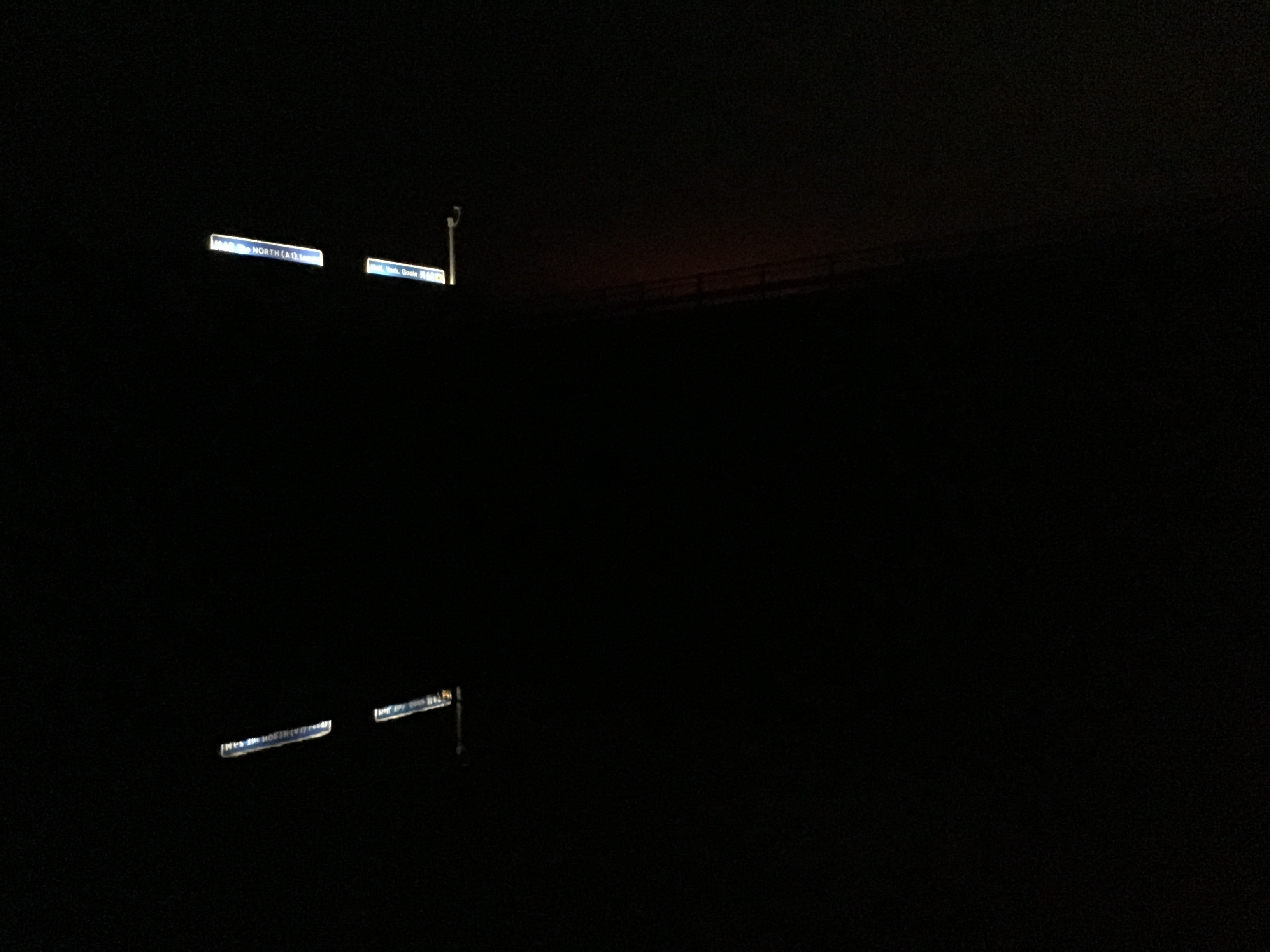
2.03am. The M18 ahead, then overhead, half a mile south of the junction with the M62. I stop for several minutes and take photographs of the backlit gantry reflected in the Aire and Calder. Most of the traffic is freight, heading north, heading west. It seems warmer now than two hours ago.
2.27am. Industrial farms to the south, cold flares, inextinguishable. The red lights recur in a different place. Rawcliffe Bridge. A nightfisherman at the towpath's edge, cross-legged on the grass verge, silent and still. Neither of us acknowledges the other. I cross the bridge to the north bank.
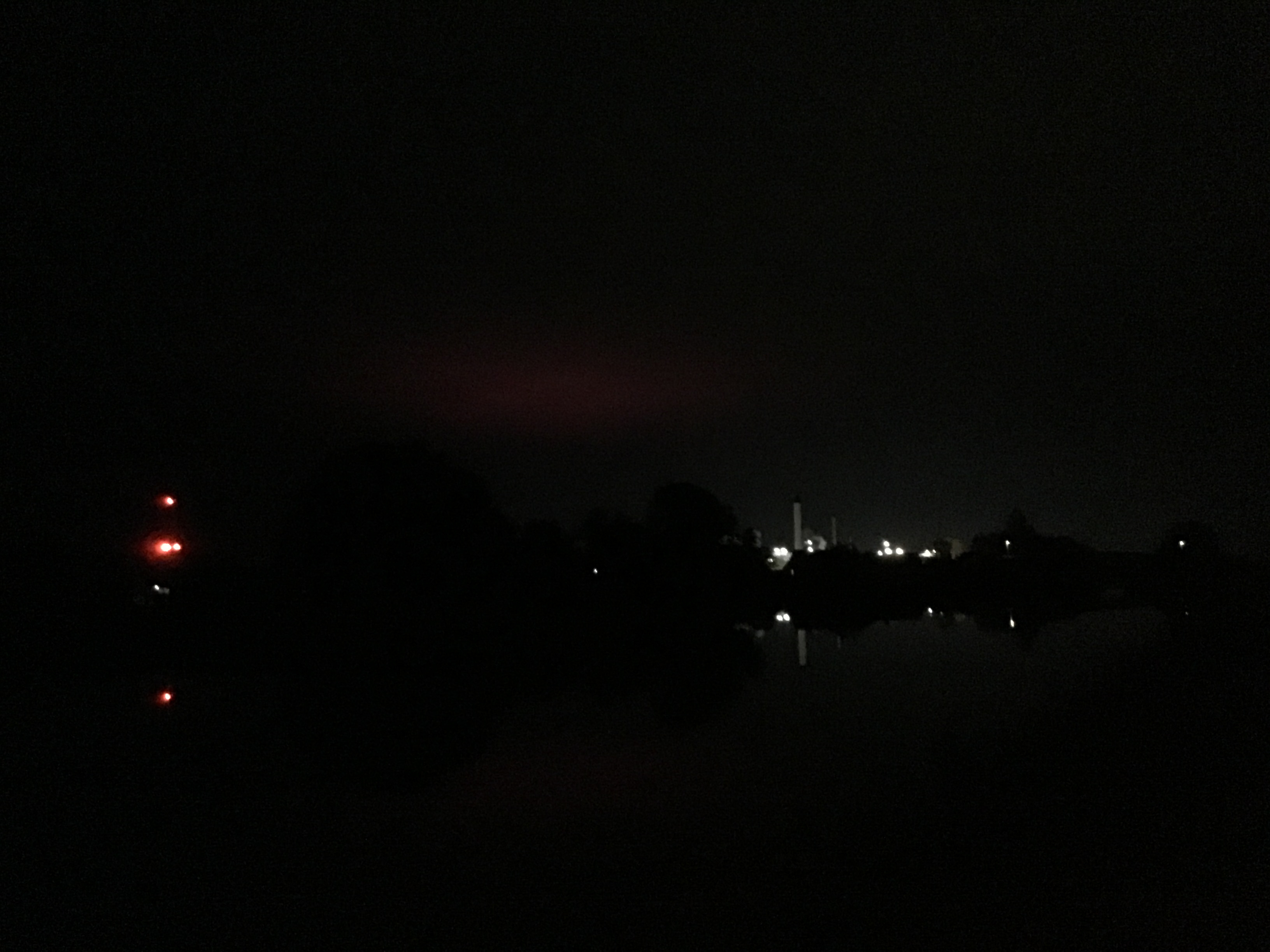
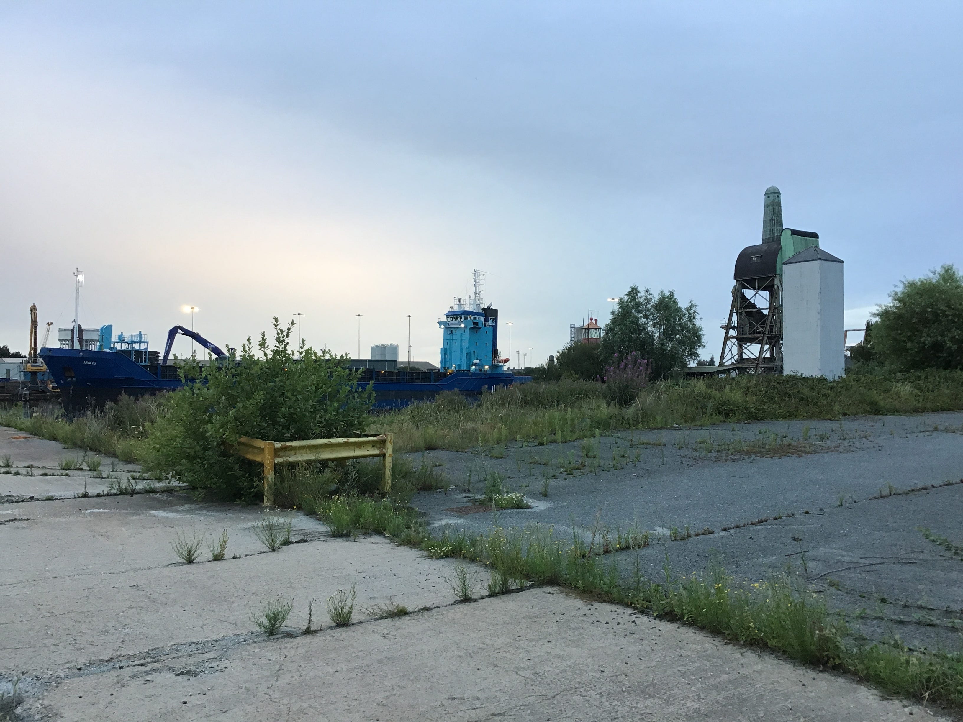
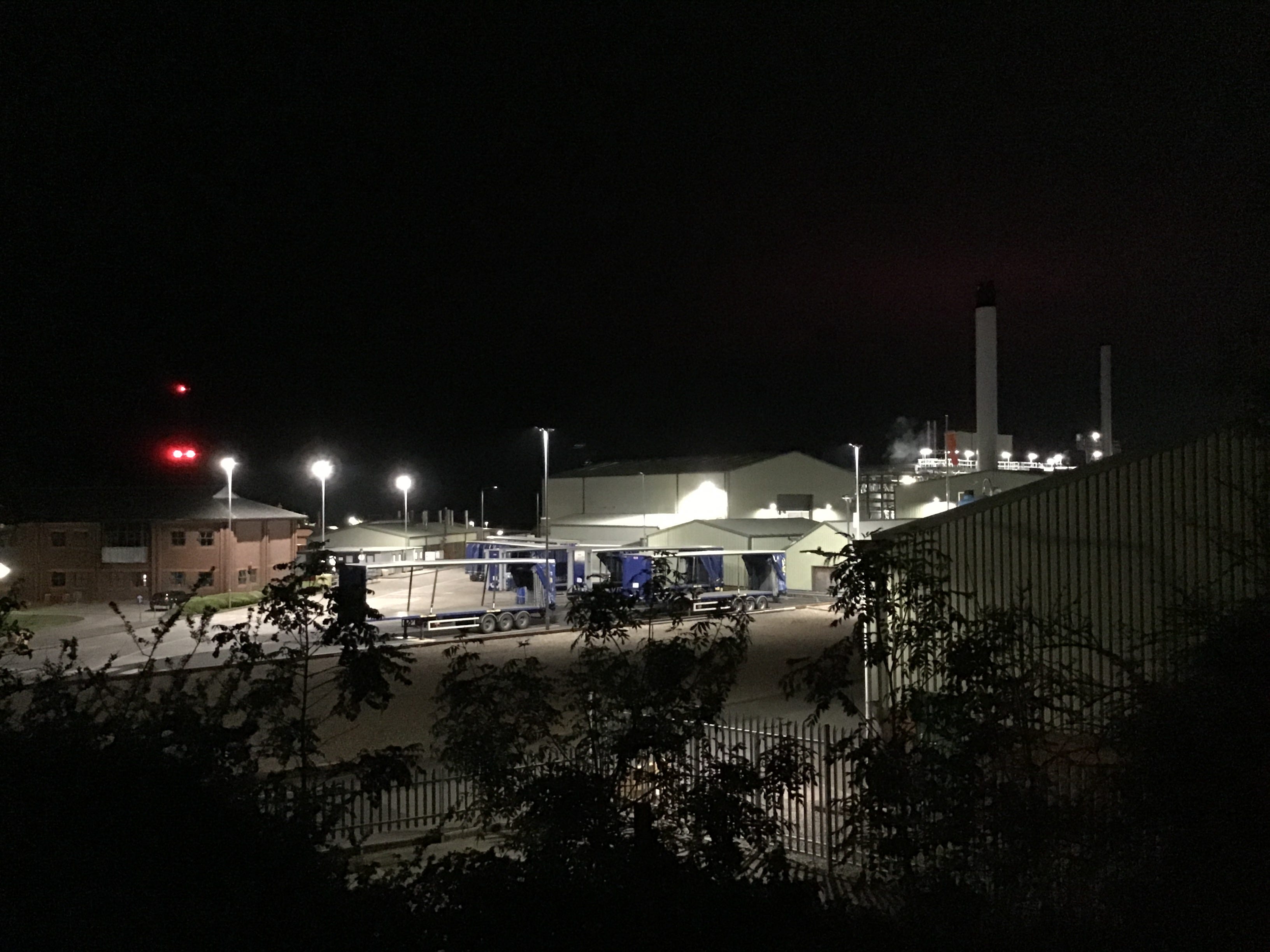
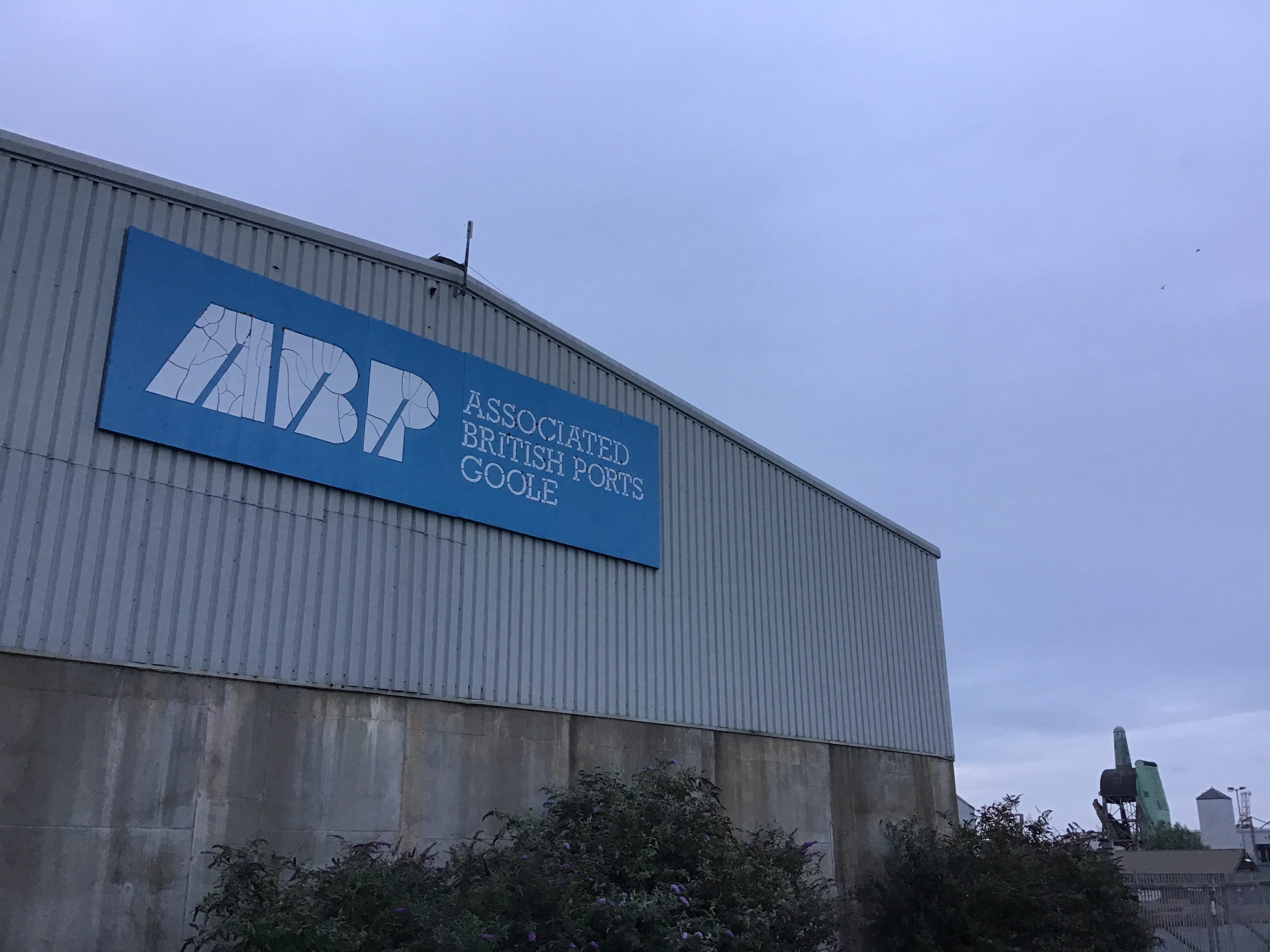
As the road clears the canal, the chimneys, yards and silos of an extensive works come into view. I piece it together through gaps in the trees, taking photographs on the descent. Signage on the steel palisades. It is Croda, a chemical plant. I hear movement - vehicles, doors - but see no-one.
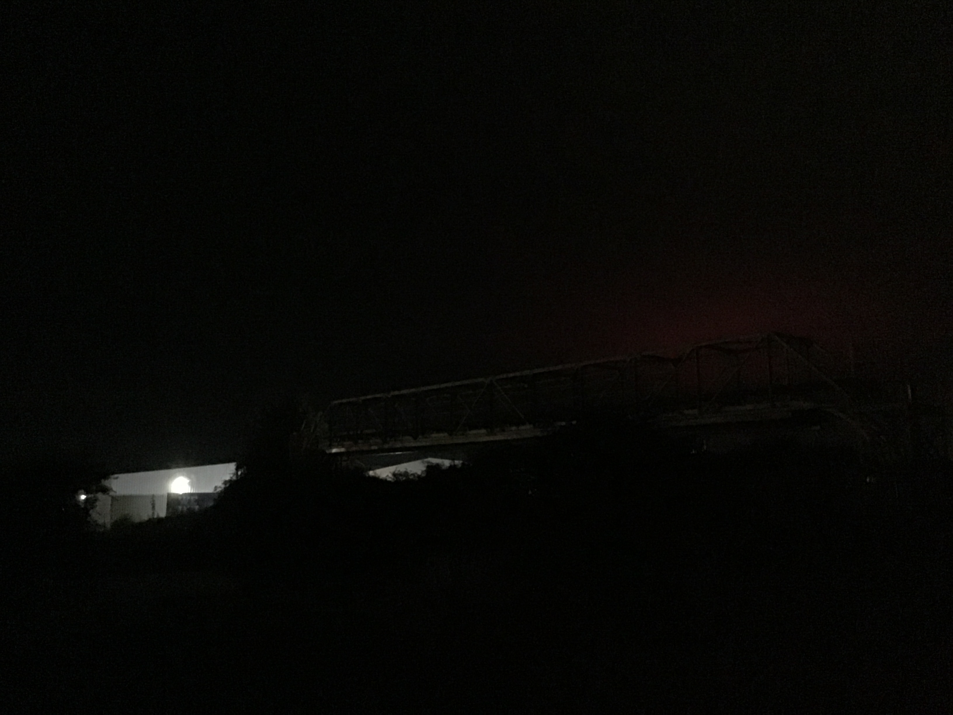
2.40am. I recross the water and slip under the bridge and find a path that meanders from the navigation in a southerly direction, via a scrappy marina and the gardens of a defunct pub. I step across a cattle grid, turn left onto another bridge, lean over the railings and is this the Dutch River.
A streetlamp at the end of the bridge. I walk to the light and stand in the light and unfold the map and stare at the blue square. It is the Dutch River. It is not the river that I remember, the river of old, its banks exposed, almost without flow. I rest on a broken stile and consider the path.
3.05am. I walk back to the canal and wind through the marina. There seem to be more cars than boats. It isn't fear that keeps me from the dark river. Is it incuriosity, though, the end of fear. What if there's nothing there? The lights of Croda now small and faint. A strange reddish glow to the north.
3.15am. A gravel track swerves from the right and overwrites the grass path. I leave the navigation and follow the track to see where it leads. It is an access path for a small substation. I cut past the palisades and stop and stretch out against the north bank of the Dutch River. A second sleep.
4.15am. I closed my eyes on a small array of red lights a few miles to the east. I open them and see the array behind the array, a wind farm, perhaps 20 turbines, the lights unblinking, the blades unmoving. Thick cloud. A cold start. I shoulder my rucksack and walk back to the canal.
4.45am. A mile of thin gravel. The Dutch River seems closer now, though I know that the distance is unchanged from 1am, 2am, 3am. The idea doesn't stand up to examination. Narrowboats and geese and what I think is fried food in the morning air. I have no appetite. I stick to the towpath.
These are not abstractions, the roads, canals and railways, the bridges and tunnels, the pipelines and pumping stations, the reservoirs and drains, yet every itinerary begins in abstraction, at 1:50,000 scale, and is measured in abstraction, the intermodal terminal a centimetre to the east.
The Dutch River was a course correction, completed in 1635, an attempt to alleviate the flooding caused by the re-routing of the Don several years earlier. It is still the Don, as it nears the Ouse, the Don turned brackish and tidal, it is more than the Don and less than the Don, all rivers and none.
I lose the navigation at the concrete plant and take the crushed white aggregate track through the copse and the utility poles stretch out ahead and parallel to the Dutch River which is running high and fast and east to west. Driftwood and debris on the turbid water. Rising banks. Sinking paths.

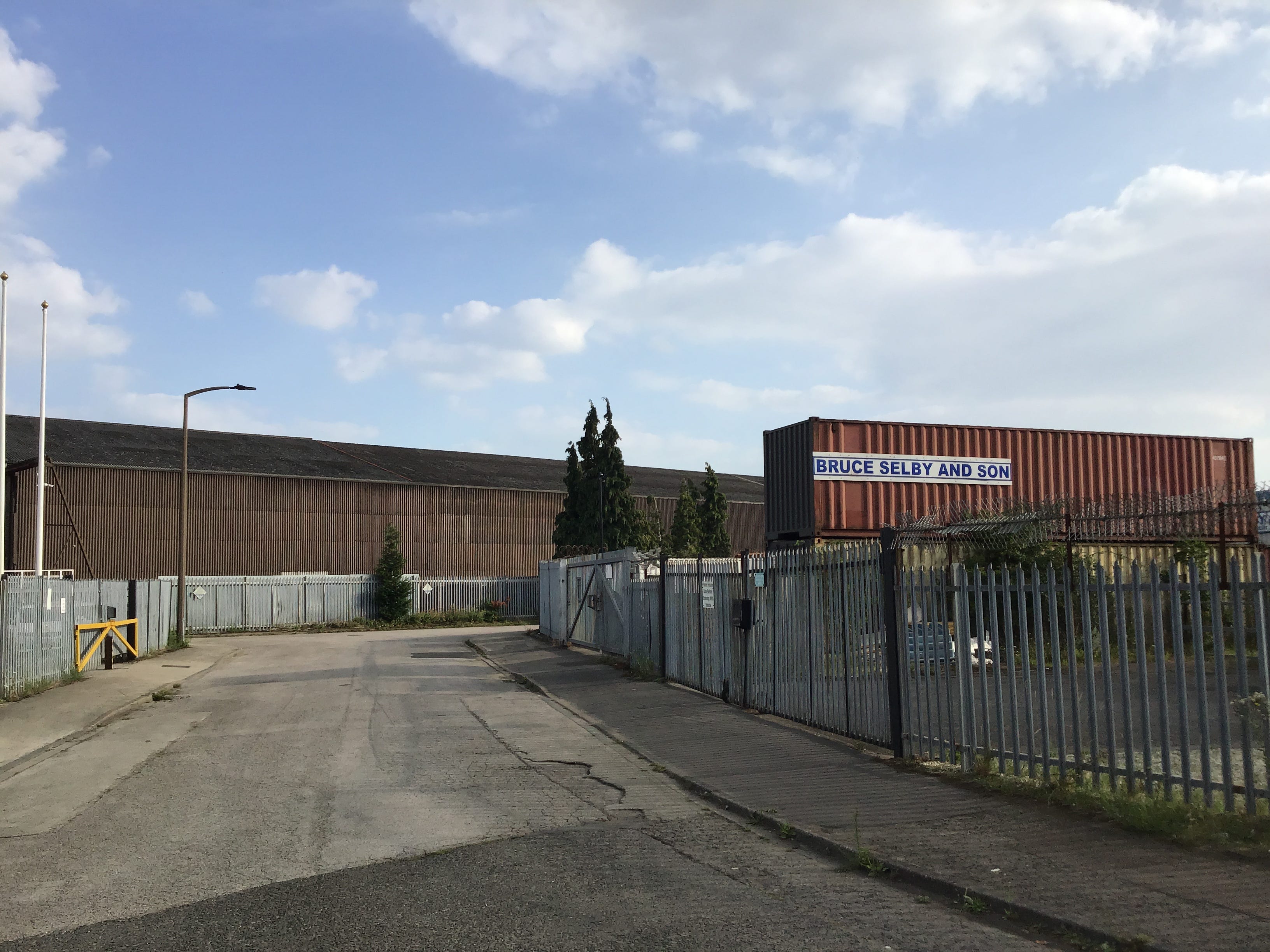
The track widens to a two-lane road, passing the entrance to the concrete plant, Spicers Auctioneers & Valuers, the marina and its cramped moorings, Spirit of the Glen, Bella Ciao, Zeus, and a quarter-mile of long low corrugated sheds, roller doors and sliding doors, palisades and pallet stacks.
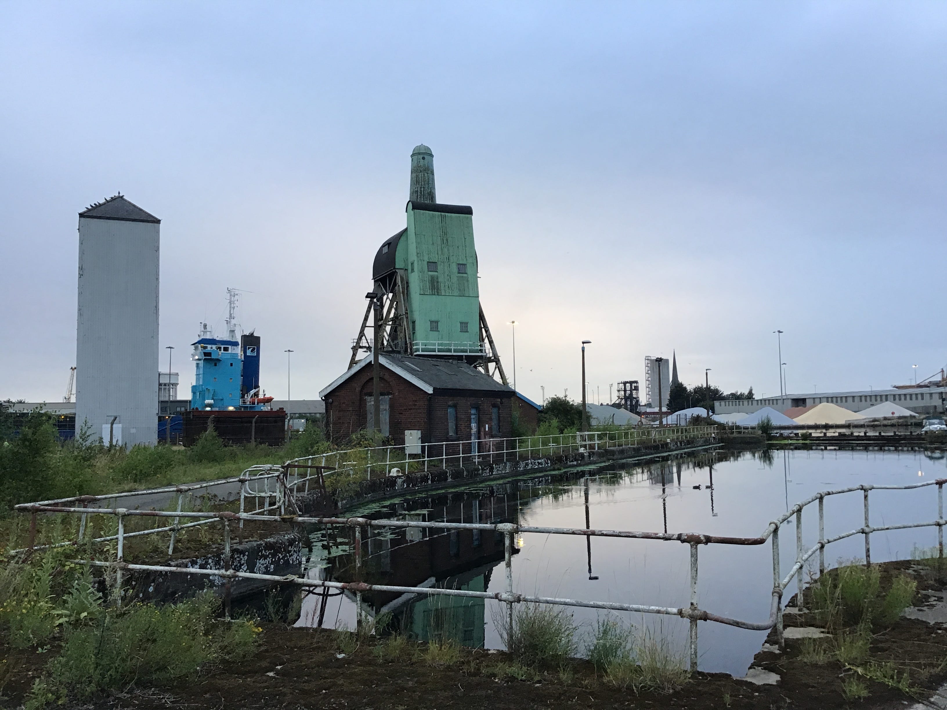
5.37am. Glasson Fertilisers. The model boat club. Group 1 Steel. I stand on the last bridge between here and Hessle and watch the Dutch River flow backwards from the Ouse. Inland sunrise. Silver and blue and grey. The faintest, softest, indeterminate rain.
I was with you all the way. Gripping, thank you.
Thank you. Immaculately observed and written.